Wetland Delineations

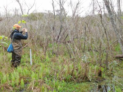
NRP is confident with the use of field instrumentation to fully identify wetlands and nonwetlands. NRP was the first wetland consultant in south Louisiana to use GPS mapping as a standard tool for delineations. NRP routinely installs shallow groundwater wells with data recorders to accurately assess wetlands hydrology on sites where hydrology is uncertain and critical. Our survey methods and results are typically accepted by the Corps of Engineers with very high accuracy.

Wetland Delineations
A wetland delineation is a specific survey that evaluates the presence of wetlands within a site. In order for an area to be considered a wetland, it must contain all three of the following: dominance of wetland plant communities, hydric wetland soils, and wetland hydrology. Wetland Delineations can also be used to obtain an official Jurisdictional Determination (JD), which is the official status of wetlands and/or other waters of the United States that are jurisdictional under Section 404 of the Clean Water Act.
Obtaining a Wetland Delineation
South Louisiana alone supports well over 30% of the wetland acreage in the Lower 48 states of the US. Thus, the majority of projects involving new land development will either impact wetlands or be forced to avoid them.